
Find Guilderland Neighbors by Parcel
Public records can answer narrow questions about the land around a Guilderland address. Start with the subject SBL, then examine each surrounding parcel on its own. The county map shows a parcel relationship, the assessment record shows the listed owner and property fields, and a deed documents a recorded conveyance. A name on one of those records is not a finding about every person who may be present at the address. The block table below separates those sources from historical and community context.
| Source | What It Shows About a Block | Access |
|---|---|---|
| Albany County Interactive Tax Parcel Map | Subject parcel geometry, road frontage, nearby polygons, and SBL context | Public map viewer; confirm a legal boundary with a deed or survey if needed |
| Albany County PROS and annual roll | Listed owner, mailing address, property class, SBL, assessment, and tax description for one parcel | Free public property search and year-specific roll reports |
| Albany County Clerk deed index | Prior conveyance parties, recording date, instrument, book or page, and legal description | Online images advertised for 1980-present; earlier research at the office or by mail |
| Street and House Directory holdings | A dated printed household or address association, cross street, ward, or later ZIP | APL, SCPL, and Hall of Records holdings; confirm each edition’s geography |
| Town interactive map | Road, boundary, zoning, environmental, and planning-area context | Public convenience viewer with a no-warranty disclaimer |
| Town partners, library, and Historical Society | Public programs, meeting, research, and civic-resource layers | Official Town, library, and Historical Society pages; no central resident directory found |
| Election tools and district links | Individual poll-site or registration function and district context | Purpose-restricted election service, not an unrestricted block roster |
For nearby parcels, the owner field and the property location must remain separate. The roll can show where tax mail goes, including a post-office box or an out-of-town address. It does not establish current occupancy. A historical directory is also time-bound: it reports a publisher’s entry for that edition, not a present-day block.
Search Guilderland Neighbor Parcels in PROS
After identifying the subject SBL on the map, use Albany County PROS to look up each adjacent address or SBL separately. Its observed fields include Street Address, Tax Map # / SBL, Owner Name, Street Finder, and Municipality. The Street Finder is a dropdown of public Albany County roads and can return addresses on the selected road, but each address still needs its own parcel check.
Record the parcel number, property location, current owner field, mailing address, property class, assessment, and tax description. PROS advertises current and past-owner paths, deed and map information, property inventory, and comparable sales. Its exact online index cutoff was not stated in the reviewed source, so preserve the retrieval date and use the annual roll year when citing a roll field.
Owners and Occupants on a Guilderland Block
An owner listed in PROS or an annual assessment roll is a property-record finding. It may be an individual, a trust, or an entity, and the mailing address may be elsewhere. It is not an occupancy result. The parcel’s situs address is the physical taxable location; its owner mailing address is for correspondence. Keep both labels visible when comparing nearby parcels.
A permit can add context about a project address, tax-map number, owner or applicant, plans, and proposed use. It still does not prove that a project was finished or that the named applicant lived there. A deed identifies the parties to the recorded instrument, while a directory or newspaper can offer a dated historical lead. Each source answers a different question about the block.
Note: A nearby parcel or mailing address is not enough to identify a person’s current connection to a Guilderland address.
Town Map Context for Guilderland Neighbors
The Town of Guilderland Interactive Mapping page shows roads, boundaries, and zoning and environmental layer controls for neighborhood context.
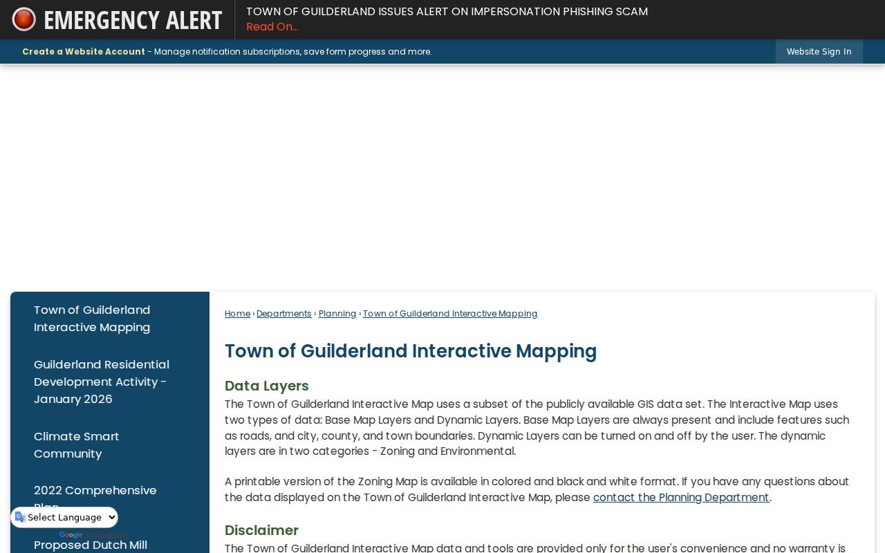
The Town viewer is useful for seeing the setting around a block, but it carries a convenience-use, third-party-data, and no-warranty disclaimer. The county parcel map remains the source for parcel geometry and adjacent-parcel review. Neither map is a legal survey or a complete ownership record.
Map a Guilderland Block Parcel by Parcel
The adjacent-parcel method is a bounded flow: address to subject SBL, SBL to parcel polygon, polygon to nearby parcel IDs, then each nearby ID to its own property record. Do not assume every visible shape touches the subject. A road, stream, right-of-way, or common area may intervene. The map is an orientation tool, and a deed or survey is the route for a legal-boundary question.
- Locate the subject address in the county parcel viewer and save its SBL, map layer, and inspection date.
- Pan and zoom to identify the next parcel along each side and across the frontage. Record the apparent relationship without calling it a legal boundary.
- Search each nearby SBL or address in PROS. Compare property location, owner field, mailing address, class, assessment, and tax description parcel by parcel.
- When a transfer needs confirmation, use the County Clerk deed index for the relevant parties and recording details. For historical household context, check an edition-specific directory, newspaper, or census source.
For a full named-road chain rather than this immediate-block method, use the Guilderland street directory. It follows the address, SBL, roll, deed, permit, and street-guide path across a road.
Guilderland Community Resource Layers
Documented local resources can add civic or historical context without creating a resident list. The reviewed Town material points to community partners, boards, the Form Center, the public library, and the Historical Society. These channels can identify a public program, resource, meeting, form category, or local-history collection. They do not establish membership, a household address, or a complete neighborhood directory.
| Documented community layer | What is available | Public access route |
|---|---|---|
| Town community and partner links | Town-connected civic, library, school, historical, fire/EMS, parks, and community information | Town of Guilderland |
| Town Form Center and public boards | Public comment and form categories, including Historical Society, Garden Club, Town Clerk, Building, Water, Parks and Recreation, Police, Courts, and EMS-related forms | Town Form Center and Town agendas or minutes |
| Guilderland Public Library | Programs, Local History Room, yearbooks, cemetery and newspaper resources, and focused research consultation | Local History and Genealogy |
| Guilderland Historical Society | Local-history programs, preservation mission, and historical-resource contact route | Town Historical Society page |
No official, current, comprehensive neighborhood-association roster or resident membership directory was located. Verify a specific organization directly before treating it as a searchable community source.
Guilderland Planning Areas Are Not Associations
The Town planning-area map names Village of Altamont, Rural Guilderland, Guilderland Center, Fort Hunter or McCormack Corners, Pine Bush, Guilderland, Westmere, and McKownville. These names help explain local geography and mixed postal labels. They are planning or geographic areas, not proof of a formal neighborhood association, a membership list, or a property-boundary definition.
The Local History Room and the Historical Society’s Mynderse-Frederick House setting can help research the history of one area. That historical context should remain separate from current parcel ownership or an individual’s private address.
Guilderland Voter Records Are Not a Block Roster
The New York voter lookup is an individual election-service tool. It asks for county, first and last name, date of birth, ZIP, and address information to support poll-site, registration, and mail-ballot functions. It does not provide a public block list, and the result fields were not fully exposed without submitting a real voter identity.
Election Law §3-103(5) requires voter-registration information to be used for an election purpose. Election Law §5-508 also provides confidential registration for eligible participants, with records kept separately under the program. An absent result, protected registration, or address mismatch cannot be used to infer where someone lives.
Note: The Albany County Board of Elections district links can help check election geography, but a district is not a household roster.
Compare Guilderland Neighbor Sources Carefully
Official records and general commercial neighbor-search categories operate differently. Official sources identify a custodian, record type, date, and limits. Commercial categories may combine older sources and offer a profile-like result, but their scope, update timing, and correction path vary. Use a public property or deed record for the narrow fact it actually records, then check the custodian when accuracy matters.
| Source type | Strength for a block question | Limit to retain |
|---|---|---|
| Official parcel, roll, map, and deed records | Named custodian, dateable parcel or instrument fields, and a direct request route | Owner, mailing, boundary, and conveyance facts each have separate meanings |
| General commercial neighbor-search category | May offer a starting lead or an older address association | Coverage, accuracy, timing, and correction procedures vary; it is not an official roster |
Private Limits on Guilderland Neighbor Searches
An address search should stop at the public record’s stated purpose. Property data may identify a parcel and listed owner. It does not disclose every person connected to an address. DMV personal information, protected voter records, sealed court material, vital records with eligibility limits, full IDs, account numbers, and confidential addresses are outside a lawful block search.
New York’s Address Confidentiality Program can provide a substitute address and confidential-record protection for eligible participants. FOIL can request agency records subject to exemptions, but it does not override those protections or election restrictions. Direct correction, redaction, or access questions to the office that holds the specific record.
Lawful personal use. Use public Guilderland records for personal research, property context, reconnecting, or civic questions. Never use a result to watch, stalk, harass, intimidate, or harm another person.